We are often asked by families how to locate the graves of their loved ones or ancestors in a particular cemetery, graveyard or churchyard. Unfortunately, there isn’t always a straightforward answer. Burial places evolve and grow over the years they are in use, as new land becomes available or specific sections are closed off as they become full. So the numbering and the way it runs throughout one graveyard can be different to another in the same area, also as to whether or not it is a Private Cemetery or a Local Authority Cemetery.
The most helpful piece of information you can have is the section and grave/plot number. You will find this information on the grave deeds, which you may find in your family’s records. If you do not have the grave deeds do you know the cemetery where your loved ones are buried? If you don’t know where they were buried, do you know where they lived and their religion? This information can make it easier to locate a grave if you are not in possession of the grave deeds. Once you have the cemetery name, the section and grave number it can be easy to locate the grave using a cemetery map.
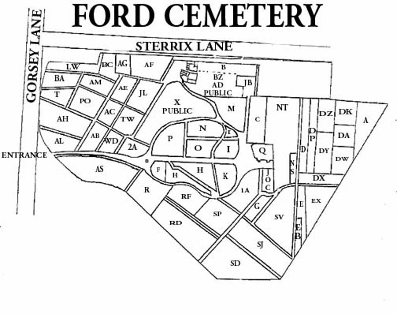
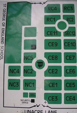
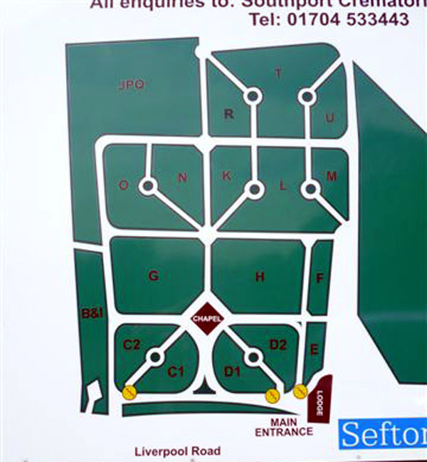
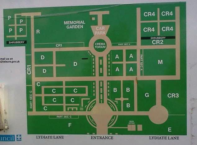
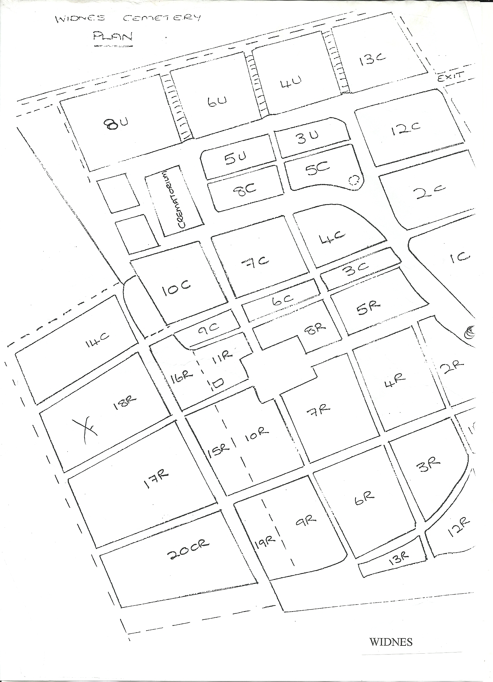
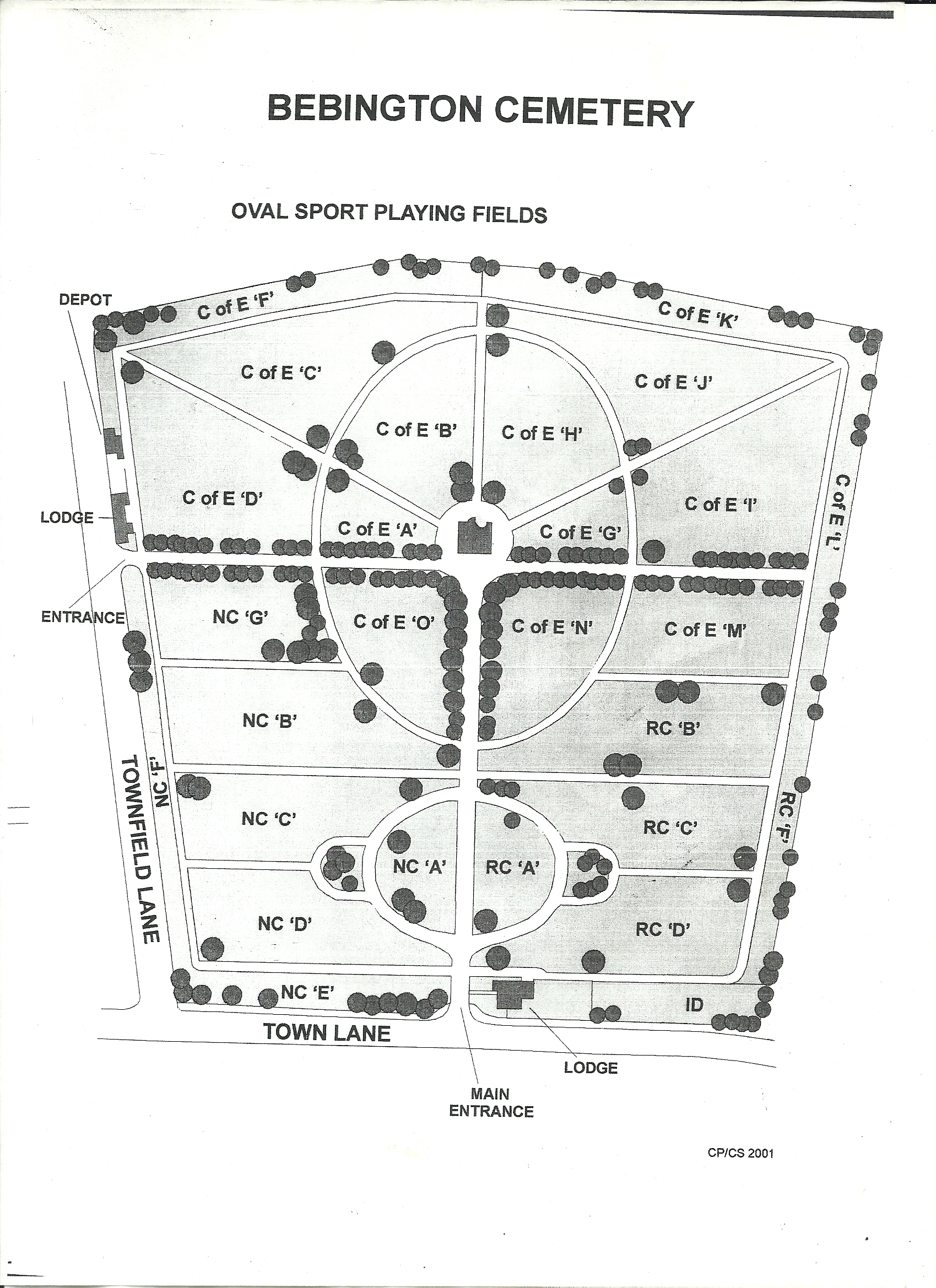
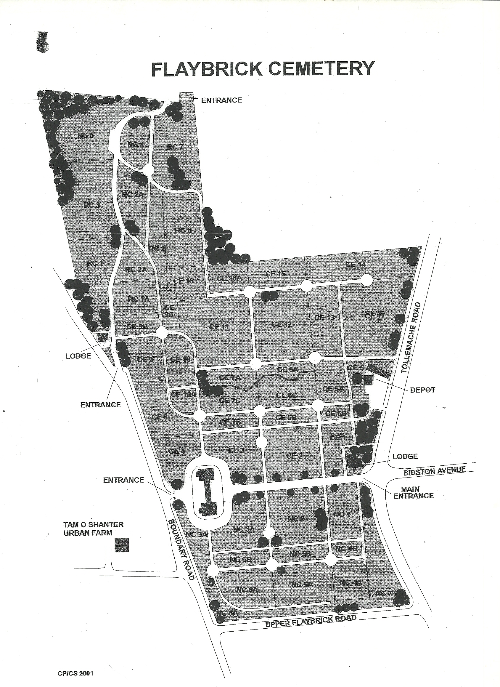
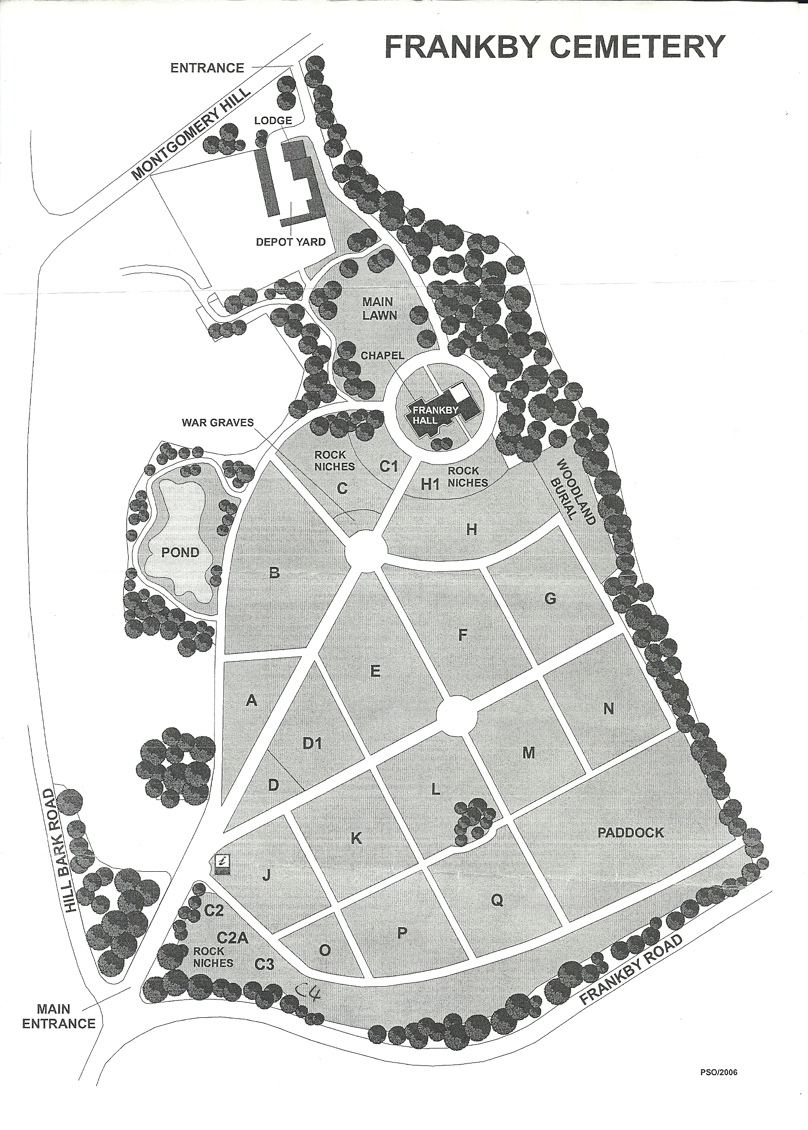
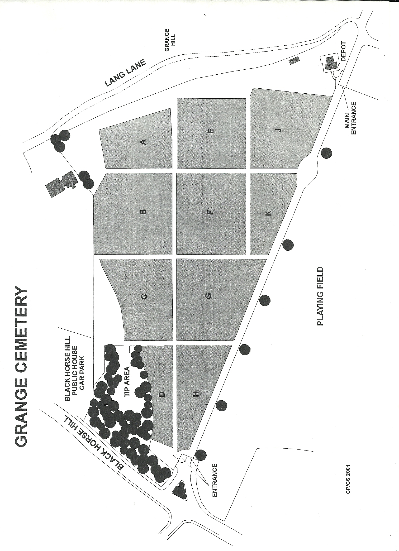
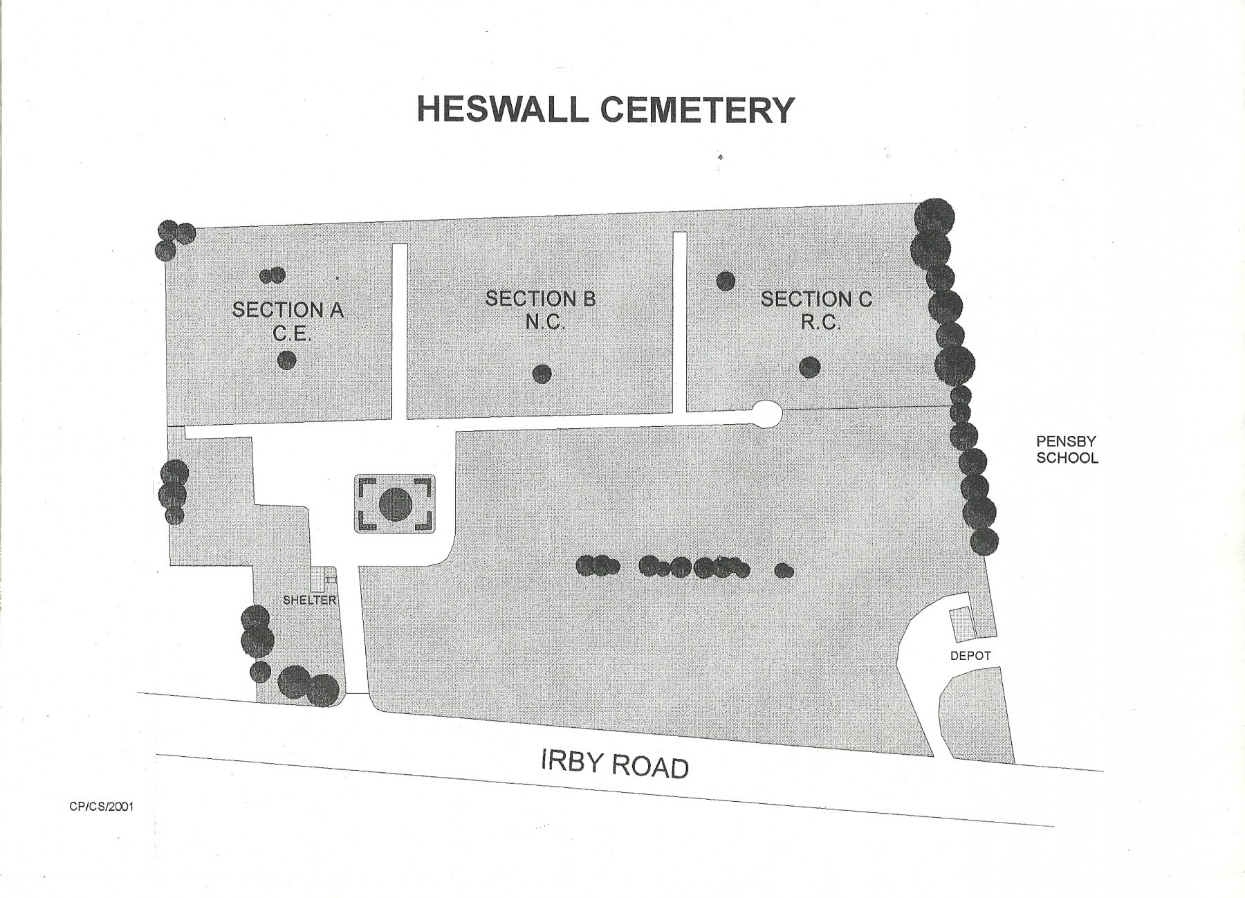
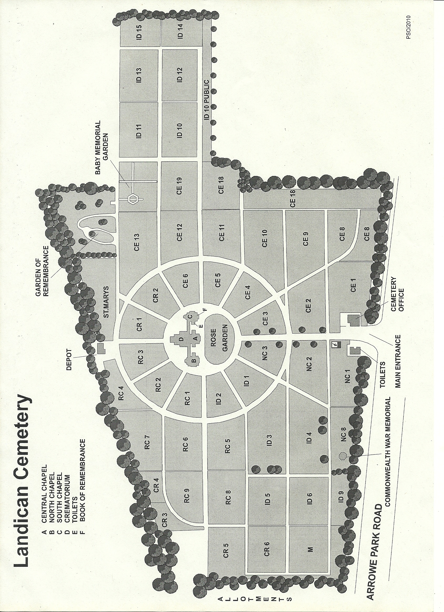
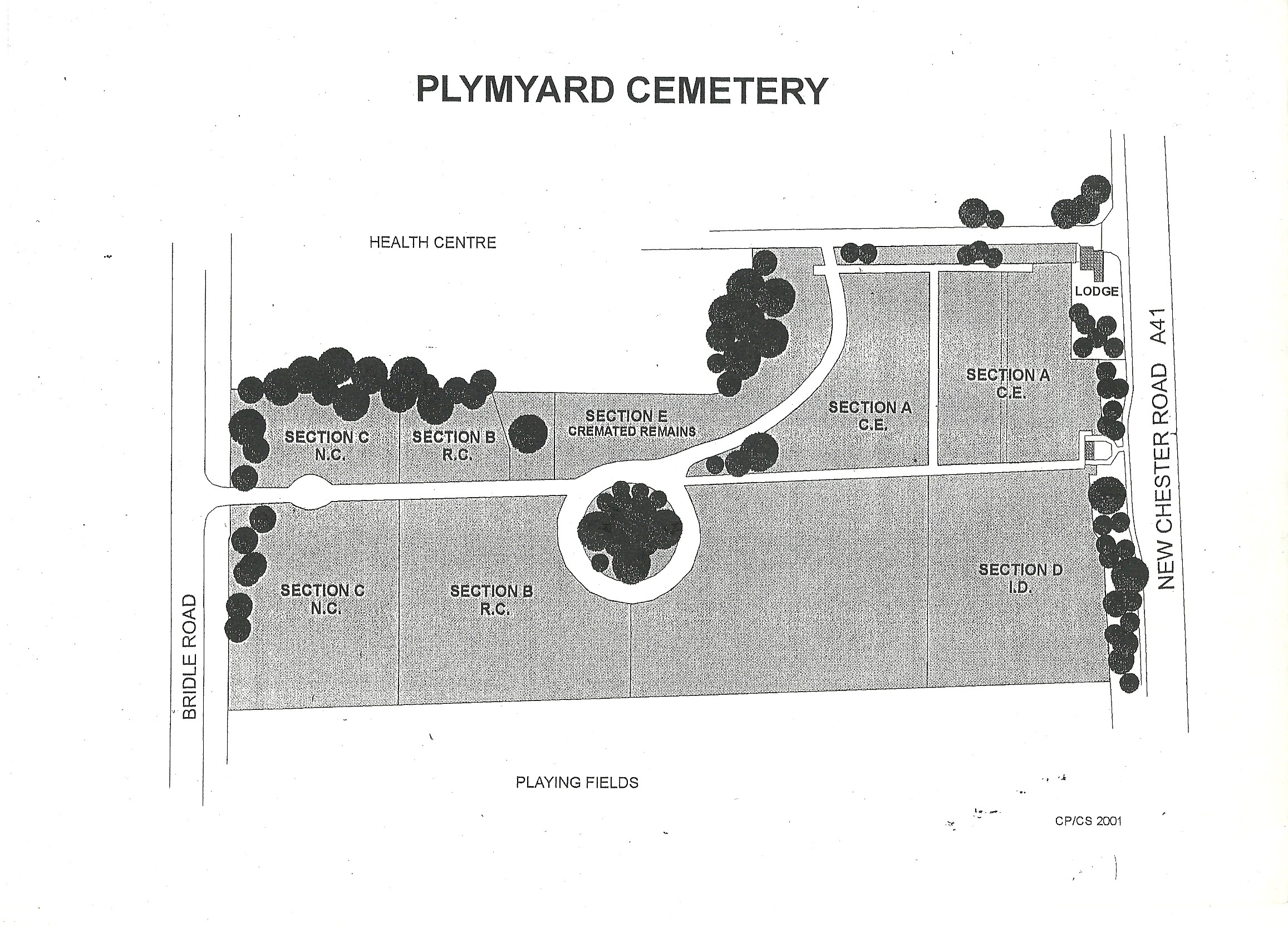
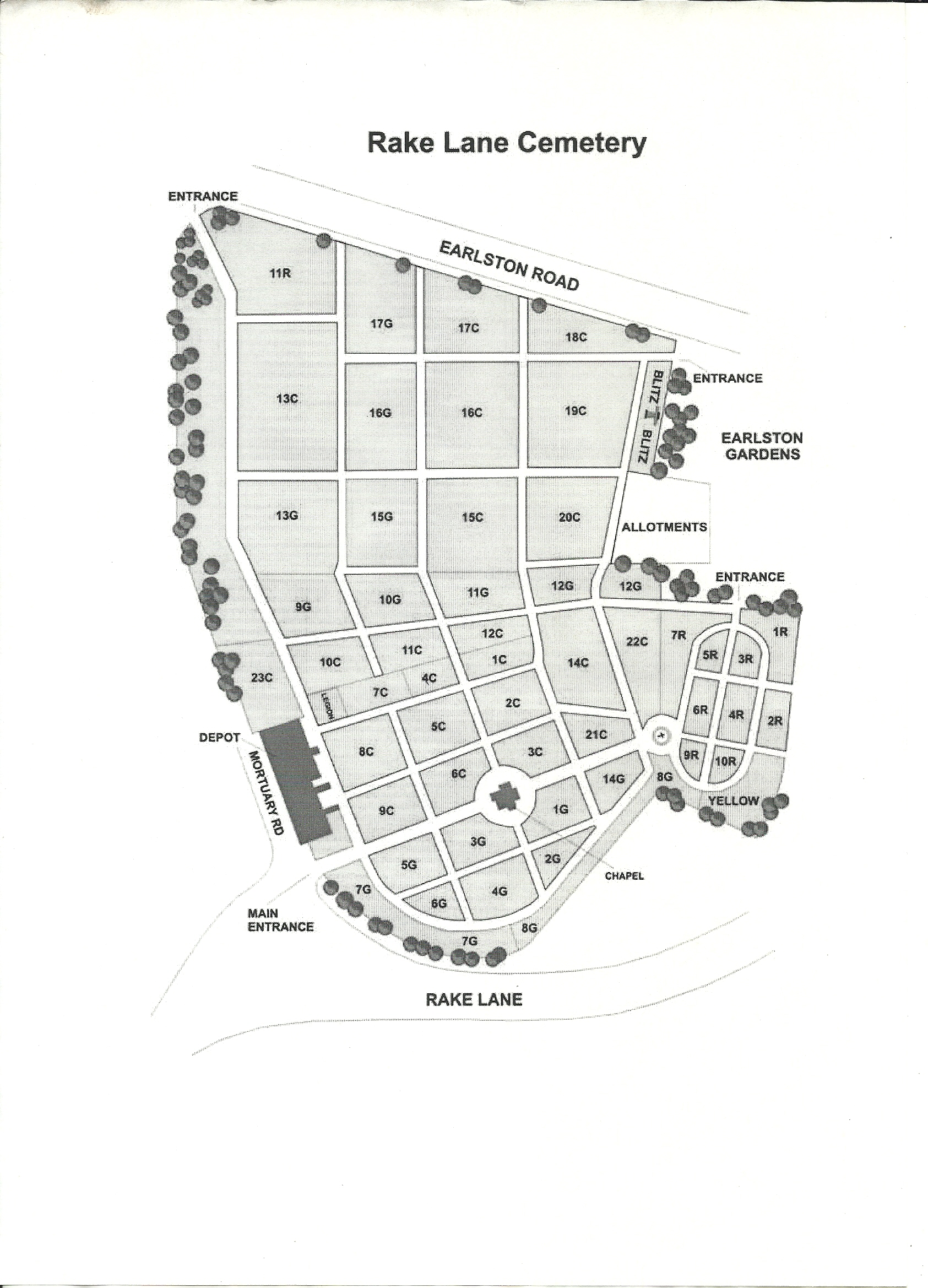
We have included some Merseyside cemetery maps showing the layout of the sections, click on the link of your preferred cemetery and print it so when you visit the cemetery it will be easier to locate a loved one’s grave.
If you require any help in locating a grave remember to contact us on 0151 228 5616 or email us at sarsfield@hotmail.co.uk for advice. We can also offer a range of services to help you honour your loved ones’ memories. Whether they have recently passed away and you are looking for that special memorial to remember them, or they are a long-forgotten ancestor whose grave you’ve found and needs some care and attention, we would be happy to help.